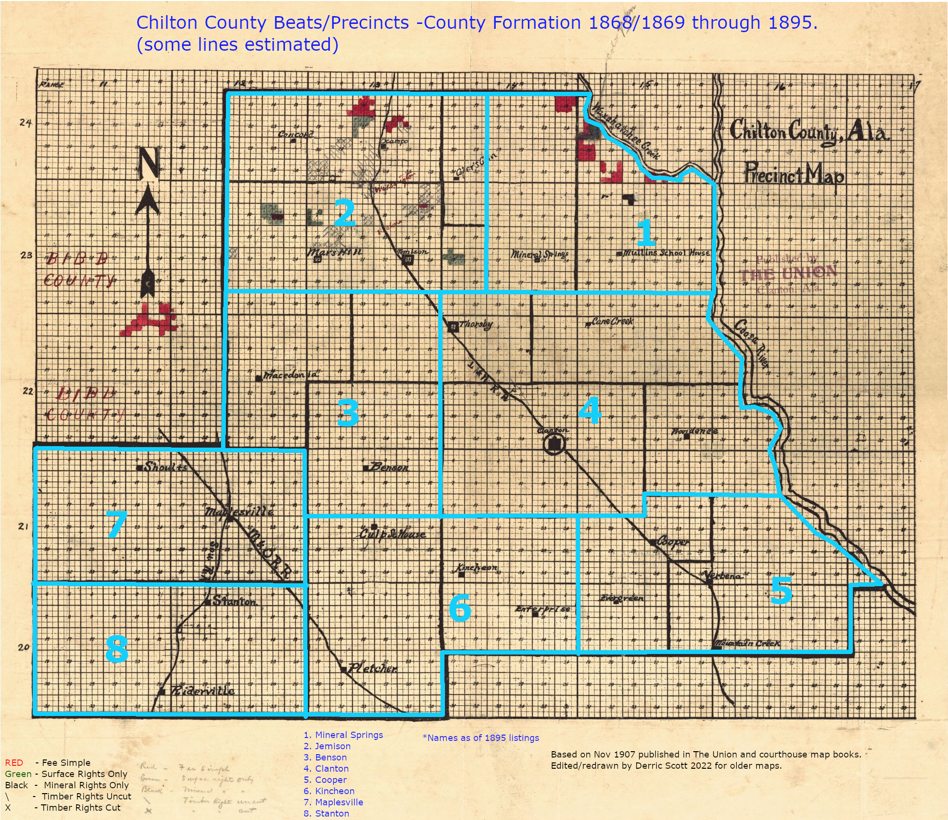
and on the right is a further breakdown of a section.
A section is 1 mile on each side (usually) and so a Township is 6 miles by 6 miles.

How the insides of those odd sections are numbered and described is largely a mystery to me.)


| Detailed List of All Tax Ledger Books Scanned | Green=index done | Yellow=index partial | |||||
|---|---|---|---|---|---|---|---|
| 1872 | 1873 | 1874 | 1875 (first by "beats") | 1877 | 1878 | 1879 | |
| 1880 | 1881 | 1882 | 1883 | 1884 | 1885 | 1887 | 1888 |
| 1889 | 1891 | 1892 | 1893-1896 | 1893 | 1894 | 1895 | 1896 |
| 1897-1900 | 1897 | 1905-1908 | 1906 book 1 | 1906 book 2 | 1907 book 1 | 1907 book 2 | 1908 |
| 1909-1912 | 1909 | 1911 book 1 | 1911 book 2 | 1911 book 3 | 1912 book 1 | 1912 book 2 | 1913 book 1 |
| 1914 book 1 | 1914 book 2 | 1915 book 1 | 1915 book 2 | ||||
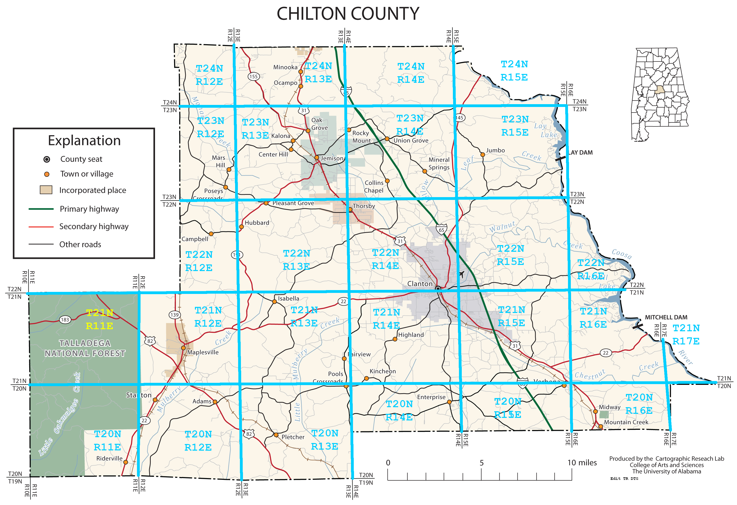
To search the tax ledger records by LAST NAMEEnter text in the field below:To search the tax ledger records by SECTION / TOWNSHIP / RANGEEnter one or more section/township/range values in the fields below and optional year:(See maps and diagrams below for rough ideas of Chilton County townships) To search the tax ledger records by COMMENTEnter search text in the field below and optional year:To browse the tax ledger records page by PAGE:To search the tax ledger records by FIRST NAMEEnter text in the field below:To search the tax ledger records by BEATEnter text in the field below: |
| Detailed List of All Tax Plat Books Scanned | ||||
|---|---|---|---|---|
| 1920-1923 | 1924-1927 | 1928-1931 | 1932-1935 | 1936-1939 |
| 1940-1943 | 1944-1949 | 1950-1955 | 1956-1961 | 1962-1967 |
| 1968-1975 | 1976-1981 | 1982-1987 | ||
|
|
|
|
The diagram on the left below shows the section breakdown of a Township (like: T23 R13) and on the right is a further breakdown of a section. A section is 1 mile on each side (usually) and so a Township is 6 miles by 6 miles. | |
|
| |
|
(Note: since the earth is a sphere and we are working with a flat map, there are a few oddities... like the sections in T23
R12 bordering T23 R13 which
narrow to almost zero width by the northern county line and expand to
full size by the lower part of the state. How the insides of those odd sections are numbered and described is largely a mystery to me.) | |
|
| |
|
| |